High Clouds
These are clouds that are based usually 20,000 ft or above, over British Isles. These include: Cirrus, Cirrocumulus, and Cirrostratus.
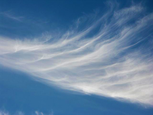
Cirrus Clouds
These clouds are the most common of the high clouds. They are composed of ice and are thin, wispy clouds blown in high winds into long streamers. Cirrus clouds are usually white and predict fair to pleasant weather. By watching the movement of cirrus clouds you can tell from which direction weather is approaching. When you see cirrus clouds, it usually indicates that a change in the weather will occur within 24 hours.
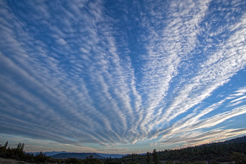
Cirrostratus clouds
These clouds are thin, sheet like high clouds that often cover the entire sky. They are so thin that the sun and moon can be seen through them i.e. they are transparent, and has smooth appearance Cirrostratus clouds usually come 12-24 hours before a rain or snow storm.
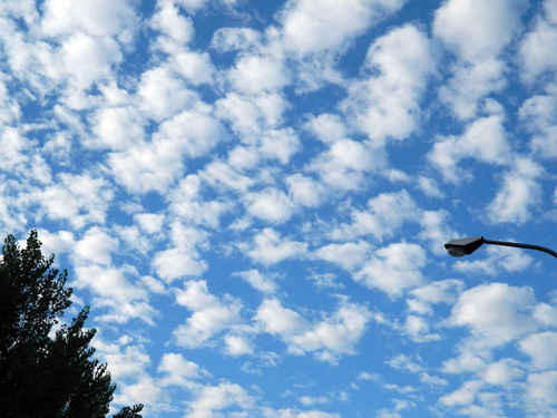
Cirrocumulus clouds
These clouds appear as small, rounded white puffs that appear in long rows. The small ripples in the cirrocumulus clouds sometime resemble the scales of a fish. Cirrocumulus clouds are usually seen in the winter and indicate fair, but cold weather. In tropical regions, they may indicate an approaching hurricane.